
les Planes d'Hostoles topographic map
Interactive map
Click on the map to display elevation.
About this map
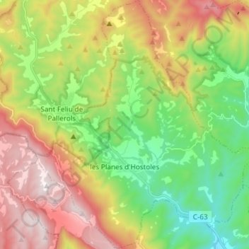
Name: les Planes d'Hostoles topographic map, elevation, terrain.
Location: les Planes d'Hostoles, Garrotxa, Gerona, Cataluña, 17172, España (42.02683 2.49492 42.11666 2.60054)
Average elevation: 601 m
Minimum elevation: 203 m
Maximum elevation: 1,152 m