
Loreto topographic map
Interactive map
Click on the map to display elevation.
About this map
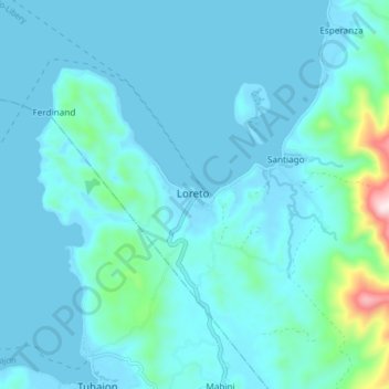
Name: Loreto topographic map, elevation, terrain.
Location: Loreto, Dinagat Islands, Caraga, Philippines (10.31925 125.53937 10.39925 125.61937)
Average elevation: 54 m
Minimum elevation: -1 m
Maximum elevation: 544 m
Other topographic maps
Click on a map to view its topography, its elevation and its terrain.
Esperanza
Philippines > Dinagat Islands > Loreto
Esperanza, Loreto, Dinagat Islands, Caraga, Philippines
Average elevation: 205 m