
Prelà topographic map
Interactive map
Click on the map to display elevation.
About this map
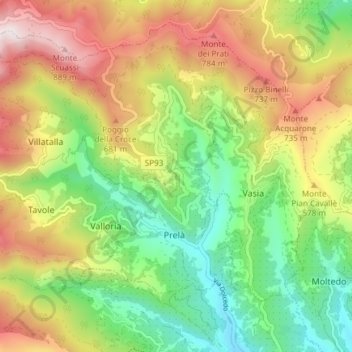
Name: Prelà topographic map, elevation, terrain.
Location: Prelà, Imperia, Ligurien, Italien (43.91706 7.87517 43.95354 7.94973)
Average elevation: 446 m
Minimum elevation: 85 m
Maximum elevation: 935 m