
Thank you for supporting this site ❤️
Make a donation
Make a donation
Chester Township topographic map
Click on the map to display elevation.
Thank you for supporting this site ❤️
Make a donation
Make a donation
About this map
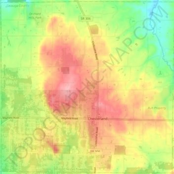
Name: Chester Township topographic map, elevation, terrain.
Location: Chester Township, Geauga County, Ohio, 44026, United States (41.49991 -81.39102 41.57015 -81.29574)
Average elevation: 339 m
Minimum elevation: 276 m
Maximum elevation: 395 m
Thank you for supporting this site ❤️
Make a donation
Make a donation
Other topographic maps
Click on a map to view its topography, its elevation and its terrain.