
Thank you for supporting this site ❤️
Make a donation
Make a donation
Habichen topographic map
Click on the map to display elevation.
Thank you for supporting this site ❤️
Make a donation
Make a donation
About this map
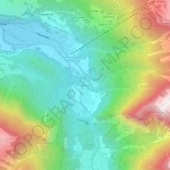
Name: Habichen topographic map, elevation, terrain.
Location: Habichen, Oetz, Bezirk Imst, Tyrol, 6433, Austria (47.17247 10.88787 47.21247 10.92787)
Average elevation: 1,305 m
Minimum elevation: 754 m
Maximum elevation: 2,421 m
Thank you for supporting this site ❤️
Make a donation
Make a donation