Geolocate

Barry County topographic map

Interactive map

Click on the map to display elevation.

About this map

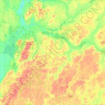
Name: Barry County topographic map, elevation, terrain.

Location: Barry County, Michigan, United States (42.41972 -85.54546 42.77073 -85.07152)

Average elevation: 268 m

Minimum elevation: 211 m

Maximum elevation: 342 m

Other topographic maps

Click on a map to view its topography, its elevation and its terrain.

Detroit

United States > Michigan > Wayne County

Detroit, Wayne County, Michigan, United States

Average elevation: 187 m

Houghton

United States > Michigan > Houghton County

Houghton, Houghton County, Michigan, 49931, United States

Average elevation: 269 m

South Haven

United States > Michigan > Van Buren County

South Haven, Van Buren County, Michigan, United States

Average elevation: 187 m

Chassell Township

United States > Michigan > Houghton County

Chassell Township, Houghton County, Michigan, 49916, United States

Average elevation: 221 m

Moline

United States > Michigan > Allegan County

Moline, Dorr Township, Allegan County, Michigan, 49335, United States

Average elevation: 239 m

Georgetown Charter Township

United States > Michigan > Ottawa County

Georgetown Charter Township, Ottawa County, Michigan, 49428, United States

Average elevation: 199 m

Macomb Township

United States > Michigan > Macomb County

Macomb Township, Macomb County, Michigan, United States

Average elevation: 186 m

Grand Beach

United States > Michigan > Berrien County > New Buffalo Township

Grand Beach, New Buffalo Township, Berrien County, Michigan, United States

Average elevation: 183 m

East Lansing

United States > Michigan > Ingham County > East Lansing

East Lansing, Ingham County, Michigan, United States

Average elevation: 261 m