
Thank you for supporting this site ❤️
Make a donation
Make a donation
Ağırnas topographic map
Click on the map to display elevation.
Thank you for supporting this site ❤️
Make a donation
Make a donation
About this map
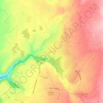
Name: Ağırnas topographic map, elevation, terrain.
Location: Ağırnas, Melikgazi, Central Anatolia Region, 38225, Turkey (38.79696 35.69736 38.83696 35.73736)
Average elevation: 1,331 m
Minimum elevation: 1,220 m
Maximum elevation: 1,393 m
Thank you for supporting this site ❤️
Make a donation
Make a donation
Other topographic maps
Click on a map to view its topography, its elevation and its terrain.