
Paradis topographic map
Interactive map
Click on the map to display elevation.
About this map
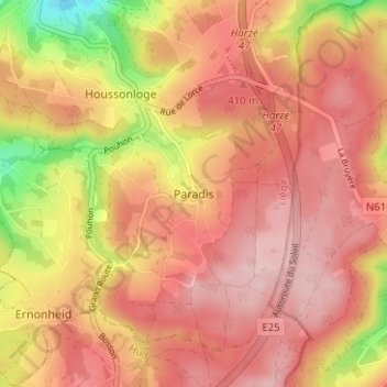
Name: Paradis topographic map, elevation, terrain.
Location: Paradis, Aywaille, Liège, Wallonie, 4920, Belgique (50.39538 5.67046 50.43538 5.71046)
Average elevation: 373 m
Minimum elevation: 240 m
Maximum elevation: 440 m
Other topographic maps
Click on a map to view its topography, its elevation and its terrain.
Remouchamps
Belgique > Liège > Liège > Aywaille
Remouchamps, Aywaille, Liège, Wallonie, 4920, Belgique
Average elevation: 222 m