
Thank you for supporting this site ❤️
Make a donation
Make a donation
Cerro Baúl topographic map
Click on the map to display elevation.
Thank you for supporting this site ❤️
Make a donation
Make a donation
About this map
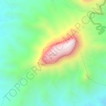
Name: Cerro Baúl topographic map, elevation, terrain.
Location: Cerro Baúl, Torata, Mariscal Nieto, Moquegua, Perú (-17.11403 -70.86338 -17.11393 -70.86328)
Average elevation: 2,181 m
Minimum elevation: 1,940 m
Maximum elevation: 2,592 m
Thank you for supporting this site ❤️
Make a donation
Make a donation
Other topographic maps
Click on a map to view its topography, its elevation and its terrain.