
Thank you for supporting this site ❤️
Make a donation
Make a donation
Crotone topographic map
Click on the map to display elevation.
Thank you for supporting this site ❤️
Make a donation
Make a donation
About this map
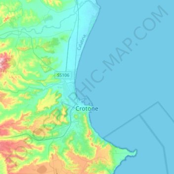
Name: Crotone topographic map, elevation, terrain.
Location: Crotone, Calabria, 88900, Italy (38.99931 17.00024 39.21369 17.20643)
Average elevation: 39 m
Minimum elevation: -1 m
Maximum elevation: 279 m
Thank you for supporting this site ❤️
Make a donation
Make a donation
Other topographic maps
Click on a map to view its topography, its elevation and its terrain.