
Make a donation
Tirur topographic map
Click on the map to display elevation.
Make a donation
Tirur
Tirur is a Town and municipality in Malappuram district in the Indian state of Kerala spread over an area of 62.34 square kilometres (24.07 sq mi). It is one of the business centers of Malappuram district and is situated 26 kilometres (16 mi) west of Malappuram and 52.5 kilometres (32.6 mi) south of Kozhikode, on the Shoranur–Mangalore section of the Mangalore–Chennai railway line. Tirur is also a major regional trading centre for fish and betel leaf and has an average elevation of 2 metres (6 ft 7 in).
Make a donation
About this map
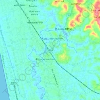
Name: Tirur topographic map, elevation, terrain.
Location: Tirur, Malappuram, Kerala, 676101, India (10.87668 75.88399 10.95668 75.96399)
Average elevation: 15 m
Minimum elevation: -2 m
Maximum elevation: 88 m
Make a donation
Other topographic maps
Click on a map to view its topography, its elevation and its terrain.