
Flamierge topographic map
Interactive map
Click on the map to display elevation.
About this map
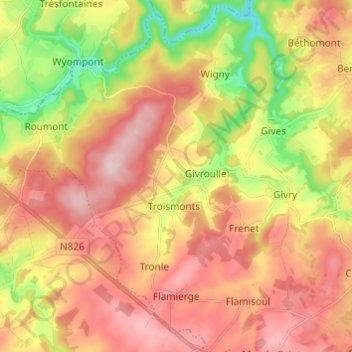
Name: Flamierge topographic map, elevation, terrain.
Average elevation: 429 m
Minimum elevation: 303 m
Maximum elevation: 526 m
Other topographic maps
Click on a map to view its topography, its elevation and its terrain.
Bertogne
België > Luxemburg > Bastenaken > Bertogne
Bertogne, Bastenaken, Luxemburg, Wallonië, 6687, België
Average elevation: 424 m