
Thank you for supporting this site ❤️
Make a donation
Make a donation
Meylan topographic map
Click on the map to display elevation.
Thank you for supporting this site ❤️
Make a donation
Make a donation
About this map
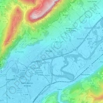
Name: Meylan topographic map, elevation, terrain.
Location: Meylan, Auvergne-Rhône-Alpes, Metropolitan France, 38240, France (45.16925 5.74120 45.24925 5.82120)
Average elevation: 405 m
Minimum elevation: 208 m
Maximum elevation: 1,348 m
Thank you for supporting this site ❤️
Make a donation
Make a donation