
Thank you for supporting this site ❤️
Make a donation
Make a donation
Fenghuang topographic map
Click on the map to display elevation.
Thank you for supporting this site ❤️
Make a donation
Make a donation
About this map
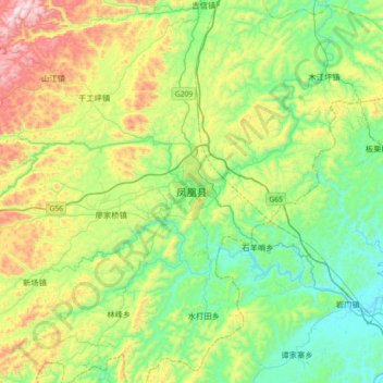
Name: Fenghuang topographic map, elevation, terrain.
Location: Fenghuang, Fenghuang County, Xiangxi, Hunan, 416200, China (27.79133 109.43420 28.11133 109.75420)
Average elevation: 422 m
Minimum elevation: 150 m
Maximum elevation: 1,022 m
Thank you for supporting this site ❤️
Make a donation
Make a donation