
Balsthal topographic map
Interactive map
Click on the map to display elevation.
About this map
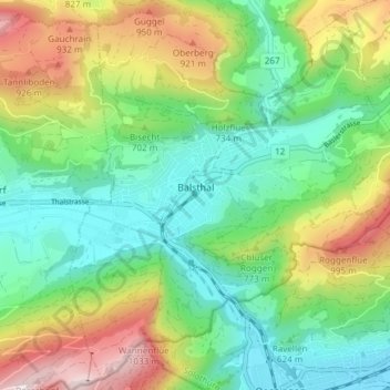
Name: Balsthal topographic map, elevation, terrain.
Location: Balsthal, Bezirk Thal, Amtei Thal-Gäu, Soleure, 4710, Suisse (47.28901 7.67040 47.33697 7.74540)
Average elevation: 680 m
Minimum elevation: 453 m
Maximum elevation: 1,112 m