
Make a donation
Medicine topographic map
Click on the map to display elevation.
Make a donation
About this map
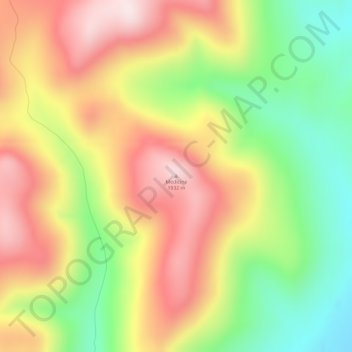
Name: Medicine topographic map, elevation, terrain.
Location: Medicine, Unorganized Borough, Alaska, United States (63.21150 -154.68965 63.21160 -154.68955)
Average elevation: 387 m
Minimum elevation: 174 m
Maximum elevation: 594 m
Make a donation
Other topographic maps
Click on a map to view its topography, its elevation and its terrain.
Adak
United States > Alaska > Unorganized Borough
Because of its naval aviation past, Adak has an unusually large and sophisticated airport for the Aleutian Islands. The airport is currently operated by the State of Alaska Department of Transportation. Complete with an Instrument Landing System, Adak Airport has no control tower and two 200 ft (61 m) wide…
Average elevation: 136 m
Kasatochi Island
United States > Alaska > Unorganized Borough
Kasatochi Island is a member of the Aleutian Islands, which lie above a narrow ridge that separates the Bering Sea from the North Pacific. It lies at the Atka Pass northwest of the western tip of Atka Island and east of Great Sitkin Island. It is at 52.177° N latitude and 175.508° W longitude, with a summit…
Average elevation: 53 m
Paxson
United States > Alaska > Unorganized Borough
Paxson has a continental subarctic climate (Köppen Dfc), closely bordering on an alpine climate (Köppen ET) due to its high elevation and northerly latitude, with only one month above the 50 degree isotherm.
Average elevation: 1,015 m
Make a donation
Make a donation
Make a donation
Make a donation