Cingoli topographic map
Click on the map to display elevation.
Cingoli
The town occupies the site of the ancient Cingulum, a town of Picenum, founded and strongly fortified by Julius Caesar's lieutenant Titus Labienus (probably on the site of an earlier village) in 63 BCE at his own expense. Its lofty position at an elevation of about 650 metres (2,130 ft) made it of some importance in the civil wars, but otherwise little is heard of it. Under the Roman Empire it was a municipium.
About this map
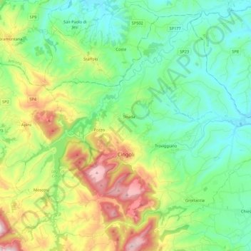
Name: Cingoli topographic map, elevation, terrain.
Location: Cingoli, Macerata, Marche, 62011, Italy (43.32164 13.12186 43.46133 13.33633)
Average elevation: 330 m
Minimum elevation: 101 m
Maximum elevation: 854 m
Other topographic maps
Click on a map to view its topography, its elevation and its terrain.