
Joshīmath topographic map
Interactive map
Click on the map to display elevation.
About this map
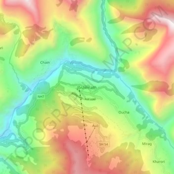
Name: Joshīmath topographic map, elevation, terrain.
Average elevation: 2,272 m
Minimum elevation: 1,326 m
Maximum elevation: 3,573 m
Joshimath (ou Jyotirmath) est une ville située dans le district de Chamoli, état de Uttarakhand au nord de l'Inde, à une altitude de 1 875 m.