
Thank you for supporting this site ❤️
Make a donation
Make a donation
Pinewood Vista topographic map
Click on the map to display elevation.
Thank you for supporting this site ❤️
Make a donation
Make a donation
About this map
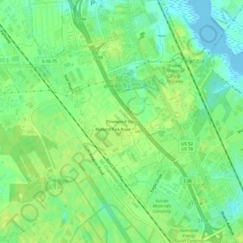
Name: Pinewood Vista topographic map, elevation, terrain.
Average elevation: 9 m
Minimum elevation: -4 m
Maximum elevation: 16 m
Thank you for supporting this site ❤️
Make a donation
Make a donation
Other topographic maps
Click on a map to view its topography, its elevation and its terrain.
North Charleston Wannamaker County Park
United States > South Carolina > Charleston County > North Charleston
Average elevation: 8 m