
Thank you for supporting this site ❤️
Make a donation
Make a donation
Les Caillats topographic map
Click on the map to display elevation.
Thank you for supporting this site ❤️
Make a donation
Make a donation
About this map
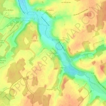
Name: Les Caillats topographic map, elevation, terrain.
Average elevation: 168 m
Minimum elevation: 139 m
Maximum elevation: 186 m
Thank you for supporting this site ❤️
Make a donation
Make a donation
Other topographic maps
Click on a map to view its topography, its elevation and its terrain.
Ancien Canal de Briare
France > Bourgogne-Franche-Comté > Yonne > Rogny-les-Sept-Écluses
Average elevation: 169 m