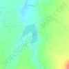
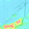
Tanhuato topographic map
Click on the map to display elevation.
Tanhuato
The municipality of Tanhuato is located at an elevation between 1,600 and 2,000 metres (5,200–6,600 ft) in the Bajío region in northwestern Michoacán. It borders the Michoacanese municipalities of Yurécuaro to the east, Ecuandureo to the southeast, Ixtlán to the southwest, and Vista Hermosa to the west. Additionally, the Lerma River forms the border between Tanhuato and the Jaliscan municipalities of Ayotlán to the northeast and La Barca to the northwest. The municipality covers an area of 228.732 square kilometres (88.314 sq mi) and comprises 0.39% of the state's area.
About this map
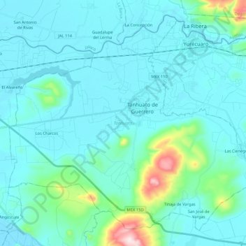
Name: Tanhuato topographic map, elevation, terrain.
Location: Tanhuato, Michoacán, Mexico (20.18632 -102.44094 20.35815 -102.23251)
Average elevation: 1,590 m
Minimum elevation: 1,525 m
Maximum elevation: 2,080 m
Other topographic maps
Click on a map to view its topography, its elevation and its terrain.
Morelia
Under the Köppen climate classification, Morelia has a subtropical highland climate (abbreviated Cwb on climate maps), with warm-to-hot days and cool nights year round due to its high elevation. Most precipitation falls during the summer monsoon season from June to September. Average monthly temperatures are…
Average elevation: 2,071 m

Morelia
Under the Köppen climate classification, Morelia has a subtropical highland climate (abbreviated Cwb on climate maps), with warm-to-hot days and cool nights year round due to its high elevation. Most precipitation falls during the summer monsoon season from June to September. Average monthly temperatures are…
Average elevation: 2,071 m

Zamora
The city of Zamora is an important economic center in the state and the most significant population center between the cities of Morelia and Guadalajara. The city is located on the Tarascan Plateau in the northwestern part of the state, at an elevation of 1,567 m (5,141 ft) above sea level. Zamora is…
Average elevation: 1,798 m



Zamora
The city of Zamora is an important economic center in the state and the most significant population center between the cities of Morelia and Guadalajara. The city is located on the Tarascan Plateau in the northwestern part of the state, at an elevation of 1,567 m (5,141 ft) above sea level. Zamora is…
Average elevation: 1,798 m



Zitácuaro
Mexico > Michoacán > Zitácuaro
Zitácuaro stands at 19°26′N 100°22′W / 19.433°N 100.367°W / 19.433; -100.367, in the northeast corner of Michoacán, some 150 km east of state capital Morelia, at an elevation of 1,942 metres above sea level. The municipality covers a total of 498 km2 and is drained by the Río Zitácuaro,…
Average elevation: 2,157 m





Morelia
Under the Köppen climate classification, Morelia has a subtropical highland climate (abbreviated Cwb on climate maps), with warm-to-hot days and cool nights year round due to its high elevation. Most precipitation falls during the summer monsoon season from June to September. Average monthly temperatures are…
Average elevation: 2,071 m