
Whittington topographic map
Interactive map
Click on the map to display elevation.
About this map
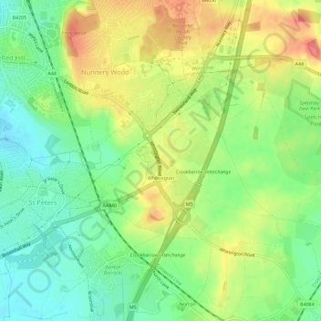
Name: Whittington topographic map, elevation, terrain.
Average elevation: 48 m
Minimum elevation: 18 m
Maximum elevation: 86 m
Other topographic maps
Click on a map to view its topography, its elevation and its terrain.
Netherton
United Kingdom > England > Wychavon > Netherton
Netherton, Wychavon, Worcestershire, West Midlands, England, WR10 3JG, United Kingdom
Average elevation: 55 m
Evesham
United Kingdom > England > Wychavon > Evesham
Evesham, Wychavon, Worcestershire, West Midlands, England, WR11, United Kingdom
Average elevation: 42 m