
Thank you for supporting this site ❤️
Make a donation
Make a donation
Leer topographic map
Click on the map to display elevation.
Thank you for supporting this site ❤️
Make a donation
Make a donation
About this map
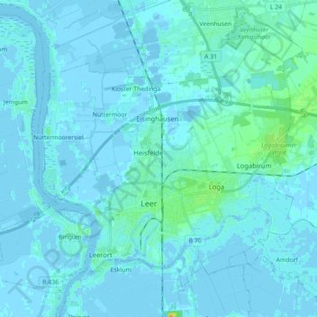
Name: Leer topographic map, elevation, terrain.
Location: Leer, Landkreis Leer, Nedersaksen, 26789, Duitsland (53.20294 7.36689 53.29229 7.54315)
Average elevation: 2 m
Minimum elevation: -5 m
Maximum elevation: 25 m
Thank you for supporting this site ❤️
Make a donation
Make a donation
Other topographic maps
Click on a map to view its topography, its elevation and its terrain.