
Thank you for supporting this site ❤️
Make a donation
Make a donation
Iriomote Island topographic map
Click on the map to display elevation.
Thank you for supporting this site ❤️
Make a donation
Make a donation
About this map
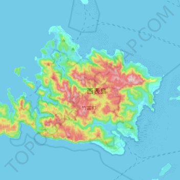
Name: Iriomote Island topographic map, elevation, terrain.
Location: Iriomote Island, Yaeyama, Okinawa Prefecture, Japan (24.25517 123.66165 24.43762 123.94066)
Average elevation: 53 m
Minimum elevation: 0 m
Maximum elevation: 444 m
Thank you for supporting this site ❤️
Make a donation
Make a donation