
Thank you for supporting this site ❤️
Make a donation
Make a donation
Salt Springs topographic map
Click on the map to display elevation.
Thank you for supporting this site ❤️
Make a donation
Make a donation
About this map
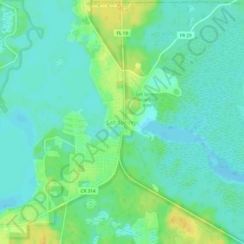
Name: Salt Springs topographic map, elevation, terrain.
Location: Salt Springs, Marion County, Florida, United States (29.33127 -81.75553 29.37127 -81.71553)
Average elevation: 9 m
Minimum elevation: -3 m
Maximum elevation: 27 m
Thank you for supporting this site ❤️
Make a donation
Make a donation
Other topographic maps
Click on a map to view its topography, its elevation and its terrain.