
Thank you for supporting this site ❤️
Make a donation
Make a donation
Tomendán topographic map
Click on the map to display elevation.
Thank you for supporting this site ❤️
Make a donation
Make a donation
About this map
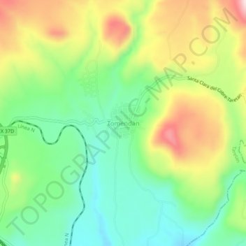
Name: Tomendán topographic map, elevation, terrain.
Location: Tomendán, Taretan, Michoacán, Mexico (19.29055 -101.88055 19.33055 -101.84055)
Average elevation: 1,028 m
Minimum elevation: 893 m
Maximum elevation: 1,233 m
Thank you for supporting this site ❤️
Make a donation
Make a donation