
Landquart topographic map
Interactive map
Click on the map to display elevation.
About this map
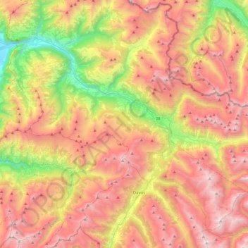
Name: Landquart topographic map, elevation, terrain.
Location: Landquart, Prättigau/Davos, Grisons, Suisse (46.77992 9.54968 46.97583 9.98432)
Average elevation: 1,866 m
Minimum elevation: 535 m
Maximum elevation: 3,101 m
Other topographic maps
Click on a map to view its topography, its elevation and its terrain.
Conters im Prättigau
Suisse > Grisons > Prättigau/Davos
Conters im Prättigau, Prättigau/Davos, Grisons, 7241, Suisse
Average elevation: 1,691 m