
Calanque d'En-Vau topographic map
Click on the map to display elevation.
About this map
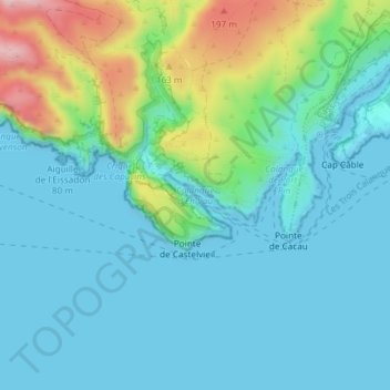
Name: Calanque d'En-Vau topographic map, elevation, terrain.
Location: Calanque d'En-Vau, Metropolitan France, 13260, France (43.20092 5.50103 43.20102 5.50113)
Average elevation: 52 m
Minimum elevation: -2 m
Maximum elevation: 244 m
Other topographic maps
Click on a map to view its topography, its elevation and its terrain.
Paris
France > Ile-de-France > Paris
Paris in its early history had only the rivers Seine and Bièvre for water. From 1809, the Canal de l'Ourcq provided Paris with water from less-polluted rivers to the north-east of the capital. From 1857, the civil engineer Eugène Belgrand, under Napoleon III, oversaw the construction of a series of new…
Average elevation: 62 m
Corsica
Under the Köppen climate classification scheme, coastal regions are characterized by a hot-summer Mediterranean climate (Csa). Further inland, a warm-summer Mediterranean climate (Csb) is more common. At the highest elevation locations, small areas with a subarctic climate (Dsc, Dfc) and the rare cold-summer…
Average elevation: 139 m
Brittany
France > Brittany > Landerneau > Loudéac
The Armorican massif reaches its maximal elevation outside of Brittany, in neighbouring Mayenne, at 417 m, and slopes towards the west before straightening on its western extremity, with the Montagnes Noires and the Monts d'Arrée. The highest hill in Brittany is the Roc'h Ruz in the Monts d'Arrée, at 385 m…
Average elevation: 50 m
Chamonix-Mont-Blanc
France > Auvergne-Rhône-Alpes > Upper Savoy
Due to its elevation, Chamonix has a humid continental climate (Dfb, according to the Köppen climate classification), with an average annual precipitation of 1,280 mm (50 in). Summers are mild and winters are cold and snowy.
Average elevation: 2,215 m
Annecy
France > Auvergne-Rhône-Alpes > Annecy
Annecy has an oceanic climate (Köppen Cfb) in spite of its relatively far inland position. Influenced by its elevation, summers are rather moderate on average, although they can be highly variable with extreme heat spikes. Winters see occasional freezing temperatures, but most often stays in the single-digits…
Average elevation: 554 m
Paris
Paris is situated on a relatively flat terrain, with its average elevation around 150 feet (45 meters) above sea level. The city lies within the Paris Basin, a low-lying area that was shaped over millennia by the meandering River Seine, which cuts through the city. Though generally flat, Paris is home to…
Average elevation: 59 m
Ardèche
The department, corresponding to the ancient province of Vivarais, is part of the current region of Auvergne-Rhône-Alpes and is surrounded by the departments of Drôme, Vaucluse, Gard, Lozère, Haute-Loire, Loire and Isère. It is a land of great contrasts: at the lowest it is at a mere 40 metres of elevation…
Average elevation: 639 m
Saint Barthélemy
Morne de Vitet, 286 metres (938 feet) in height, is the highest peak on the island. Hills and valleys of varying topography cover the rest of the island. Notable are Morne Rouge, Morne Criquet, Morne de Grand Fond, Morne de Dépoudré and Morne Lurin. The largest bodies of water on the island are Étang de…
Average elevation: 4 m
Les Houches
France > Auvergne-Rhône-Alpes > Upper Savoy
Les Houches, located 6 kilometres from Chamonix, is a ski resort with a domain which extends from an altitude of 950 metres up to 1900 metres. Long descents through tree-lined slopes are combined with impressive views of the Mont Blanc massif and the Chamonix valley.
Average elevation: 1,728 m
Réserve naturelle des Aiguilles rouges
France > Auvergne-Rhône-Alpes > Upper Savoy > Chamonix-Mont-Blanc
Average elevation: 1,951 m
Toulouse
France > Occitania > Haute-Garonne
The first half of the 14th century was a prosperous period, despite the dismemberment in 1317 of the very large bishopric of Toulouse (which lost two thirds of its area and a large part of its income, a loss only partially compensated by its elevation to the rank of archbishopric), and the episode of the…
Average elevation: 155 m
Alata
France > Corsica > South Corsica
Alata is 7 km north of the city of Ajaccio and the village is at an altitude of 400m. Alata borders the sea in the Gulf of Lava which is in the Gulf of Sagone. The geographic boundaries of the town are between the Monte Gozzi, the Gulf of Lava, La Punta - Pozzo di Borgo, Ajaccio, Villanova, Appietto and Afa…
Average elevation: 196 m
Saint-Lô
The square of the town hall was completely redeveloped in the 1990s. The city organised a large demonstration on the occasion of the fiftieth anniversary of the Normandy landings. The edges of the Vire were reconfigured with the rehabilitation of the towpath and the creation of a green beach, at the Place du…
Average elevation: 68 m
Penmarc'h
The territory of the town (16.39 km2) is particularly flat; its altitude ranges from -1 to 23 m amsl. There are many marshy lagoons, some of which have been drained and filled, especially in St. Guénolé to save space or habitat for the installation of local handicrafts.
Average elevation: 7 m
Pontarlier
France > Bourgogne – Franche-Comté > Doubs
Nestled in the heart of the Jura Mountains near the Swiss border, the town lies along the Doubs River and occupies the Arlier plain at approximately 830–837 m elevation. It is overshadowed by the Grand Taureau peak, which reaches 1,323 m.
Average elevation: 906 m
Grenoble
France > Auvergne-Rhône-Alpes > Isère
Except for a few dozen houses on the slopes of the Bastille hill of Chartreuse, Grenoble is exclusively built on the alluvial plain of the rivers Isère and Drac at an altitude of 214 metres (702 ft). As a result, the city itself is extremely flat. Mountain sports are an important tourist attraction in summer…
Average elevation: 246 m
85390
France > Pays de la Loire > Vendée > Mouilleron-Saint-Germain > Mouilleron-en-Pareds
Average elevation: 108 m
Guadeloupe
The main two islands are Basse-Terre (west) and Grande-Terre (east), which form a butterfly shape as viewed from above, the two 'wings' of which are separated by the Grand Cul-de-Sac Marin, Rivière Salée and Petit Cul-de-Sac Marin. More than half of Guadeloupe's land surface consists of the 847.8 km2…
Average elevation: 37 m
Verchaix
France > Auvergne-Rhône-Alpes > Upper Savoy
Verchaix is located on a small plateau above the north bank of the river Giffre. The commune spans an altitude of 654m to 2092m.
Average elevation: 1,257 m
Saint-Jean-de-Maurienne
France > Auvergne-Rhône-Alpes > Savoy
Saint-Jean-de-Maurienne is on the route of the future Lyon-Turin rail link. Homes, businesses, the current railway station and the rescue centre are affected by the project. The Lyon Turin Railway company (LTF) which manages the construction projects plans to build new railway station in the Sous-le-Bourg…
Average elevation: 947 m
Chamonix-Mont-Blanc
France > Auvergne-Rhône-Alpes > Upper Savoy
Due to its elevation, Chamonix has a humid continental climate (Dfb, according to the Köppen climate classification), with an average annual precipitation of 1,280 mm (50 in). Summers are mild and winters are cold and snowy.
Average elevation: 2,202 m
Barcelonnette
France > Provence-Alpes-Côte d'Azur > Alpes-de-Haute-Provence
Barcelonnette is situated in the wide and fertile Ubaye Valley, of which it is the largest town. It lies at an elevation of 1132 m (3717 ft) on the right bank of the Ubaye River, and is surrounded by mountains which reach peaks of over 3000 m; the tallest of these is the Needle of Chambeyron at 3412 m.…
Average elevation: 1,478 m