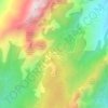
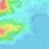
Alata topographic map
Click on the map to display elevation.
Alata
Alata is 7 km north of the city of Ajaccio and the village is at an altitude of 400m. Alata borders the sea in the Gulf of Lava which is in the Gulf of Sagone. The geographic boundaries of the town are between the Monte Gozzi, the Gulf of Lava, La Punta - Pozzo di Borgo, Ajaccio, Villanova, Appietto and Afa (neighbouring communes) with its 3250 hectares of scrub and large forests of oak.
About this map

Name: Alata topographic map, elevation, terrain.
Average elevation: 196 m
Minimum elevation: -4 m
Maximum elevation: 807 m
Other topographic maps
Click on a map to view its topography, its elevation and its terrain.