
Thank you for supporting this site ❤️
Make a donation
Make a donation
Serra San Quirico topographic map
Click on the map to display elevation.
Thank you for supporting this site ❤️
Make a donation
Make a donation
About this map
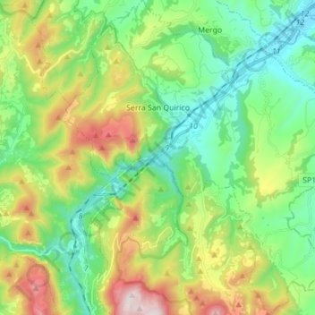
Name: Serra San Quirico topographic map, elevation, terrain.
Location: Serra San Quirico, Ancona, 60048, Italy (43.38116 12.97279 43.48173 13.09256)
Average elevation: 424 m
Minimum elevation: 120 m
Maximum elevation: 1,064 m
Thank you for supporting this site ❤️
Make a donation
Make a donation
Other topographic maps
Click on a map to view its topography, its elevation and its terrain.