
Thank you for supporting this site ❤️
Make a donation
Make a donation
Kaggere topographic map
Click on the map to display elevation.
Thank you for supporting this site ❤️
Make a donation
Make a donation
About this map
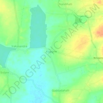
Name: Kaggere topographic map, elevation, terrain.
Location: Kaggere, Gubbi taluk, Tumakuru, Karnataka, 572117, India (13.39370 76.93875 13.43370 76.97875)
Average elevation: 801 m
Minimum elevation: 786 m
Maximum elevation: 822 m
Thank you for supporting this site ❤️
Make a donation
Make a donation