
Thank you for supporting this site ❤️
Make a donation
Make a donation
勐崖 topographic map
Click on the map to display elevation.
Thank you for supporting this site ❤️
Make a donation
Make a donation
About this map
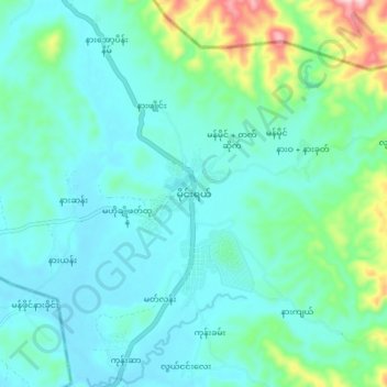
Name: 勐崖 topographic map, elevation, terrain.
Location: 勐崖, 勐崖镇区, 当阳县, 掸邦, 缅甸 (22.38679 97.99908 22.46679 98.07908)
Average elevation: 906 m
Minimum elevation: 849 m
Maximum elevation: 1,150 m
Thank you for supporting this site ❤️
Make a donation
Make a donation
Other topographic maps
Click on a map to view its topography, its elevation and its terrain.