
Coimo topographic map
Click on the map to display elevation.
About this map
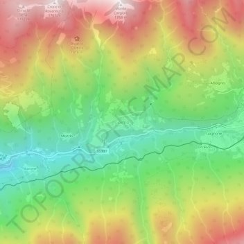
Name: Coimo topographic map, elevation, terrain.
Location: Coimo, Druogno, Verbano-Cusio-Ossola, Piedmont, Italy (46.11253 8.37782 46.15253 8.41782)
Average elevation: 1,087 m
Minimum elevation: 528 m
Maximum elevation: 1,761 m
Other topographic maps
Click on a map to view its topography, its elevation and its terrain.
Lake Maggiore
Italy > Piedmont > Verbano-Cusio-Ossola
Lake Maggiore weather is humid subtropical (Cfa in the Köppen climate classification). During winter, the lake helps to maintain a higher temperature in the surrounding region (since water releases heat energy more slowly than air). The temperatures are cooled down in summer by the breezes that blow on the…
Average elevation: 655 m
Ghiacciaio del Belvedere
Italy > Piedmont > Verbano-Cusio-Ossola > Macugnaga
Average elevation: 2,211 m