
Río Tabasará topographic map
Interactive map
Click on the map to display elevation.
About this map
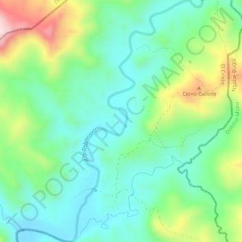
Name: Río Tabasará topographic map, elevation, terrain.
Location: Río Tabasará, El Cristo, Distrito Tolé, Chiriquí, Panamá (8.31395 -81.60250 8.35167 -81.58192)
Average elevation: 261 m
Minimum elevation: 145 m
Maximum elevation: 530 m