
Thank you for supporting this site ❤️
Make a donation
Make a donation
Marble Mountain topographic map
Click on the map to display elevation.
Thank you for supporting this site ❤️
Make a donation
Make a donation
About this map
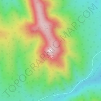
Name: Marble Mountain topographic map, elevation, terrain.
Location: Marble Mountain, Clearwater County, Alberta, Canada (51.90281 -115.20689 51.90291 -115.20679)
Average elevation: 1,560 m
Minimum elevation: 1,399 m
Maximum elevation: 1,810 m
Thank you for supporting this site ❤️
Make a donation
Make a donation
Other topographic maps
Click on a map to view its topography, its elevation and its terrain.
Thank you for supporting this site ❤️
Make a donation
Make a donation
Cutoff Creek Equestrian Staging Public Land Recreation Area
Canada > Alberta > Clearwater County
Average elevation: 1,509 m
Thank you for supporting this site ❤️
Make a donation
Make a donation
Hummingbird Public Land Recreation Area
Canada > Alberta > Clearwater County
Average elevation: 1,830 m
Thank you for supporting this site ❤️
Make a donation
Make a donation