
Thank you for supporting this site ❤️
Make a donation
Make a donation
Tiengen topographic map
Click on the map to display elevation.
Thank you for supporting this site ❤️
Make a donation
Make a donation
About this map
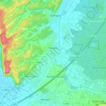
Name: Tiengen topographic map, elevation, terrain.
Location: Tiengen, Freiburg im Breisgau, Baden-Württemberg, Germany (47.96878 7.68282 47.99427 7.76387)
Average elevation: 226 m
Minimum elevation: 200 m
Maximum elevation: 313 m
Thank you for supporting this site ❤️
Make a donation
Make a donation
Other topographic maps
Click on a map to view its topography, its elevation and its terrain.