
Thank you for supporting this site ❤️
Make a donation
Make a donation
Asheboro topographic map
Click on the map to display elevation.
Thank you for supporting this site ❤️
Make a donation
Make a donation
About this map
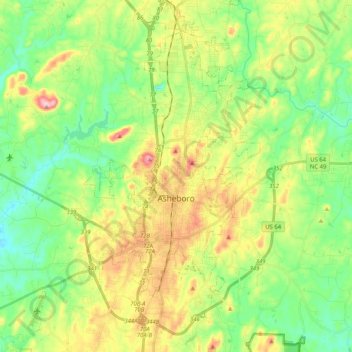
Name: Asheboro topographic map, elevation, terrain.
Location: Asheboro, Randolph County, North Carolina, United States (35.64477 -79.96995 35.79158 -79.76473)
Average elevation: 208 m
Minimum elevation: 130 m
Maximum elevation: 343 m
Thank you for supporting this site ❤️
Make a donation
Make a donation