
Mont Dore topographic map
Interactive map
Click on the map to display elevation.
About this map
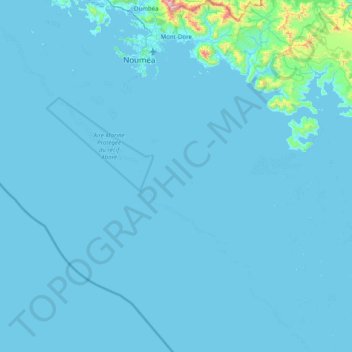
Name: Mont Dore topographic map, elevation, terrain.
Location: Mont Dore, Province Sud, Nouvelle-Calédonie, France (-22.88171 166.47990 -22.15178 166.97892)
Average elevation: 29 m
Minimum elevation: -2 m
Maximum elevation: 1,051 m
Other topographic maps
Click on a map to view its topography, its elevation and its terrain.
La Coulée (fleuve)
France > Province Sud > Mont Dore
La Coulée (fleuve), Mont Dore, Province Sud, Nouvelle-Calédonie, France
Average elevation: 226 m
Nouméa
Nouméa, Province Sud, Nouvelle-Calédonie, 98800, France
Average elevation: 8 m