
Thank you for supporting this site ❤️
Make a donation
Make a donation
Lannach topographic map
Click on the map to display elevation.
Thank you for supporting this site ❤️
Make a donation
Make a donation
About this map
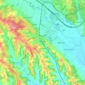
Name: Lannach topographic map, elevation, terrain.
Location: Lannach, Bezirk Deutschlandsberg, Styria, 8502, Austria (46.91110 15.29096 46.97278 15.35041)
Average elevation: 351 m
Minimum elevation: 316 m
Maximum elevation: 429 m
Thank you for supporting this site ❤️
Make a donation
Make a donation
Other topographic maps
Click on a map to view its topography, its elevation and its terrain.