
Setajaqui (Setajaqui del Rio) topographic map
Interactive map
Click on the map to display elevation.
About this map
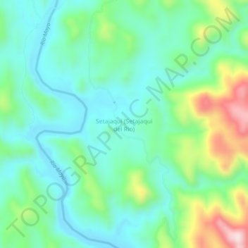
Name: Setajaqui (Setajaqui del Rio) topographic map, elevation, terrain.
Location: Setajaqui (Setajaqui del Rio), Álamos, Sonora, México (27.49933 -108.87667 27.53933 -108.83667)
Average elevation: 311 m
Minimum elevation: 195 m
Maximum elevation: 623 m
Other topographic maps
Click on a map to view its topography, its elevation and its terrain.