Geolocate

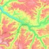
Senlis-le-Sec topographic map

Click on the map to display elevation.

About this map

Name: Senlis-le-Sec topographic map, elevation, terrain.

Location: Senlis-le-Sec, Péronne, Somme, Hauts-de-France, Metropolitan France, 80300, France (50.01115 2.55268 50.04546 2.59998)

Average elevation: 106 m

Minimum elevation: 69 m

Maximum elevation: 142 m

Other topographic maps

Click on a map to view its topography, its elevation and its terrain.

Petit-Camon

France > Hauts-de-France > Somme > Camon

Average elevation: 73 m

Amiens

France > Hauts-de-France > Somme > Amiens

Average elevation: 86 m

Larronville

France > Hauts-de-France > Somme > Rue

Average elevation: 8 m