
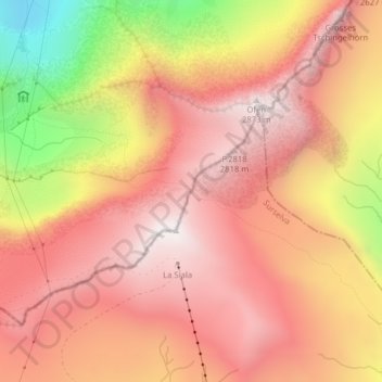
Grischsattel topographic map
Interactive map
Click on the map to display elevation.
About this map
Name: Grischsattel topographic map, elevation, terrain.
Average elevation: 2,461 m
Minimum elevation: 1,661 m
Maximum elevation: 2,881 m
Other topographic maps
Click on a map to view its topography, its elevation and its terrain.
Piz Segnas
Schweiz > Graubünden > Flims
Piz Segnas, Flims, Imboden, Graubünden, Schweiz
Average elevation: 2,594 m
Fil de Cassons
Schweiz > Graubünden > Flims
Fil de Cassons, Flims, Imboden, Graubünden, 7017, Schweiz
Average elevation: 2,346 m