

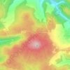
Altenahr topographic map
Click on the map to display elevation.
About this map

Name: Altenahr topographic map, elevation, terrain.
Location: Altenahr, Landkreis Ahrweiler, Rijnland-Palts, Duitsland (50.49775 6.94097 50.54661 7.02957)
Average elevation: 301 m
Minimum elevation: 128 m
Maximum elevation: 523 m
Other topographic maps
Click on a map to view its topography, its elevation and its terrain.


Rodderberg
Duitsland > Rijnland-Palts > Landkreis Ahrweiler > Remagen > Rolandswerth
Average elevation: 106 m


