
Thank you for supporting this site ❤️
Make a donation
Make a donation
Beshamoun topographic map
Click on the map to display elevation.
Thank you for supporting this site ❤️
Make a donation
Make a donation
Beshamoun
Bechamoun (Arabic: بشامون), is a town near Beirut in the Mount Lebanon Governorate of Lebanon. It has an area about 6.6 square kilometres and elevation between 60 and 580 metres above sea level. It lies 8 kilometres from Beirut’s airport and central Beirut. The town has a population of greater than 15,000.
Thank you for supporting this site ❤️
Make a donation
Make a donation
About this map
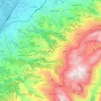
Name: Beshamoun topographic map, elevation, terrain.
Average elevation: 402 m
Minimum elevation: -1 m
Maximum elevation: 957 m
Thank you for supporting this site ❤️
Make a donation
Make a donation