
Tongatapu topographic map
Interactive map
Click on the map to display elevation.
About this map
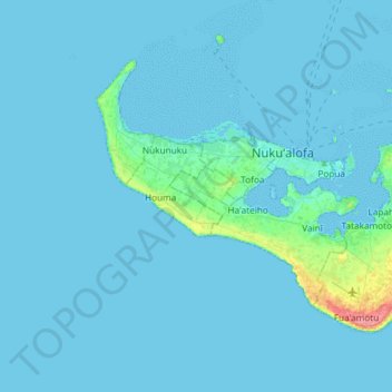
Name: Tongatapu topographic map, elevation, terrain.
Location: Tongatapu, Vahe Vaini, Tongatapu, Tonga (-21.27316 -175.35651 -21.06249 -175.03143)
Average elevation: 4 m
Minimum elevation: 0 m
Maximum elevation: 70 m
Other topographic maps
Click on a map to view its topography, its elevation and its terrain.