
Thank you for supporting this site ❤️
Make a donation
Make a donation
Eagle Creek topographic map
Click on the map to display elevation.
Thank you for supporting this site ❤️
Make a donation
Make a donation
About this map
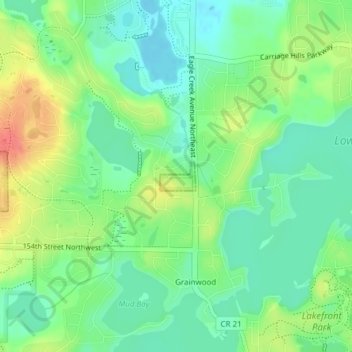
Name: Eagle Creek topographic map, elevation, terrain.
Location: Eagle Creek, Scott County, Minnesota, United States (44.72916 -93.44325 44.73142 -93.43937)
Average elevation: 284 m
Minimum elevation: 261 m
Maximum elevation: 322 m
Thank you for supporting this site ❤️
Make a donation
Make a donation
Other topographic maps
Click on a map to view its topography, its elevation and its terrain.