
Thank you for supporting this site ❤️
Make a donation
Make a donation
Rome topographic map
Click on the map to display elevation.
Thank you for supporting this site ❤️
Make a donation
Make a donation
About this map
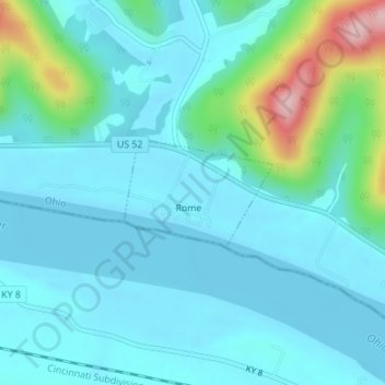
Name: Rome topographic map, elevation, terrain.
Location: Rome, Green Township, Adams County, Ohio, United States (38.66151 -83.38443 38.66812 -83.37353)
Average elevation: 185 m
Minimum elevation: 151 m
Maximum elevation: 357 m
Thank you for supporting this site ❤️
Make a donation
Make a donation
Other topographic maps
Click on a map to view its topography, its elevation and its terrain.