
Thank you for supporting this site ❤️
Make a donation
Make a donation
New Trenton topographic map
Click on the map to display elevation.
Thank you for supporting this site ❤️
Make a donation
Make a donation
About this map
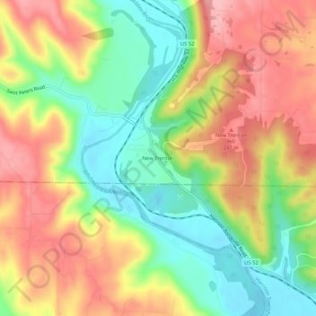
Name: New Trenton topographic map, elevation, terrain.
Location: New Trenton, Franklin County, Indiana, 47035, United States (39.28950 -84.92051 39.32950 -84.88051)
Average elevation: 230 m
Minimum elevation: 159 m
Maximum elevation: 302 m
Thank you for supporting this site ❤️
Make a donation
Make a donation
Other topographic maps
Click on a map to view its topography, its elevation and its terrain.