
Thank you for supporting this site ❤️
Make a donation
Make a donation
Les Lilas topographic map
Click on the map to display elevation.
Thank you for supporting this site ❤️
Make a donation
Make a donation
About this map
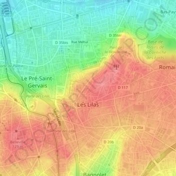
Name: Les Lilas topographic map, elevation, terrain.
Average elevation: 98 m
Minimum elevation: 51 m
Maximum elevation: 135 m
Thank you for supporting this site ❤️
Make a donation
Make a donation
Other topographic maps
Click on a map to view its topography, its elevation and its terrain.
Noisy-le-Grand
France > Ile-de-France > Seine-Saint-Denis > Noisy-le-Grand > Noisy-le-Grand
Average elevation: 70 m