
Möösli topographic map
Interactive map
Click on the map to display elevation.
About this map
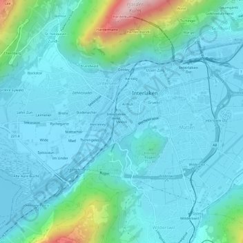
Name: Möösli topographic map, elevation, terrain.
Average elevation: 674 m
Minimum elevation: 556 m
Maximum elevation: 1,395 m
Other topographic maps
Click on a map to view its topography, its elevation and its terrain.
Aarzälg
Suisse > Berne > Arrondissement administratif d'Interlaken-Oberhasli > Interlaken
Aarzälg, Interlaken, Arrondissement administratif d'Interlaken-Oberhasli, Région administrative de l'Oberland, Berne, 3800, Suisse
Average elevation: 726 m